Generalized Wasserstein Deep Forest: An Interpretable Deep Learning Model for Imbalanced Learning
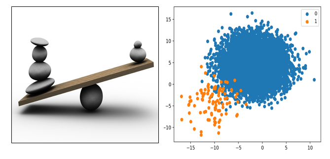
The arena of research in “learning from imbalanced data” continues to grow, largely driven by challenging problems including fraud detection, face recognition, spam and anomaly detection, medical diagnosis, etc. The overarching question is how to push the boundaries of prediction on the underrepresented or minority classes while managing the trade-off with false positives? The solution space ranges from sampling approaches to new imbalanced learning algorithms designed specifically for imbalanced datasets. Despite the progress the deep learning methods have made, there are still several challenges that they ignore or cannot handle well as follows: (a) Model explainability and interpretability; (b) High dimensionality; and (c) Classifying extreme samples and unseen categories. Deep learning methods, like ensemble deep learning model, knowledge-shot learning, and dynamic curriculum learning for imbalanced data classification incur high time complexity than traditional neural networks and can classify unseen classes only if the knowledge vector of these classes is artificially given.
This project aims to design an interpretable, scalable deep model that can handle high-dimensional imbalanced data sets arising in various applied AI domain
Deep Generative Models to Improve Learning Process in Geospatial and Earth Science Applications
Generative models learn the distribution of the training data and help in generating new data points from the learned distribution by sampling those distribution. In most cases, Gaussian distribution of the data are assumed. Further, a deep generative model is an unsupervised learning technique that learns the distribution of the training data while optimizing the loss function of the model network.
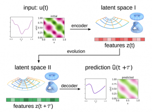
The aim of this work is to propose novel methods which utilize trained deep generative models for improving the deep learning models on diverse geospatial dataset for Earth science applications using two deep generative techniques namely VAE and GANs. We propose to address:
- Problem of imbalanced data classification – We propose to use VAE and GANs for learning the data distribution followed by structure preserving oversampling techniques for generating the new data samples.
- Dynamical systems – A dynamical system function describes the time dependence of a point in a geometrical space. The model learns from observation data a set of lower dimensional representations that are used to make predictions for the dynamics.
- Domain adaptation – Nonavailability of reliable labelled geospatial data is a main challenge for machine learning techniques. VAE and GAN can be used for domain adaptation in an unsupervised manner.
- Adversarial attacks – Adversarial attacks come in the form of adversarial examples: carefully crafted perturbations added to a legitimate input sample. These perturbations cause the legitimate sample to be misclassified at inference time. Such perturbations change the output of the classifier. Non-deterministic generative samples from VAE and GAN can be used for adversarial training.
UAV data analysis for agriculture/forestry applications in North-Eastern States of India using Machine Learning
(In partnership with neuralblocks.ai and NESAC (North Eastern Space Application Center), Shillong, Meghalaya)
- The goal of this project was to identify the future potential areas for sericulture, agriculture and forestry in north-eastern states of India. The direct beneficiaries of the solution were the people of north east India.
- The project execution location was predominantly focussed to Assam and neighbouring states where MUGA and ERI silks are grown in abundant. Since MUGA plantation is wild in nature so conventional process of selecting the potential area in newer locations needs extensive ground work, human resources and thus a costly affair.
- Without cutting in to the core agriculture practicing cultivable areas, remote sensing (RS), artificial intelligence (AI) and Geographic Information System (GIS) techniques were effectively used in identifying newer areas with higher potential so that focus can be made to the specific areas for expansion of sericulture activities.
- The same technology can be used for identification of various crops in future from a high spatial resolution imagery such as UAV data, precision farming, yield forecast, health of the soil, etc.
Objectives:
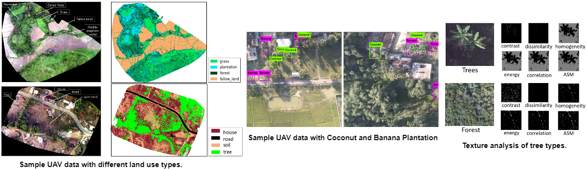
- To develop suitable automated classification system for discrimination of crops and other land use categories from UAV imageries such as crops, grass, plantation, trees/forest, fallow land, barren land, roads and house/buildings/settlements.
- To develop suitable classification algorithm for identifying MUGA and ERI silks in Assam, Shillong and other north-eastern states of India.
Sample UAV images:
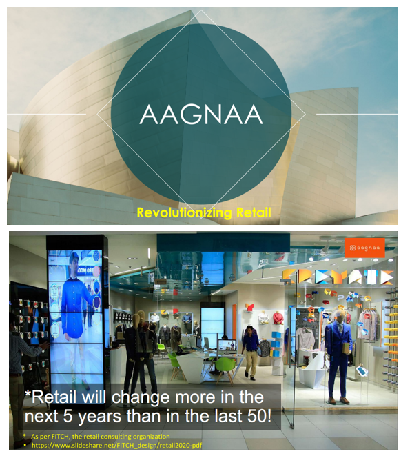
Revolutionising the Retail
(In partnership with Aagna)
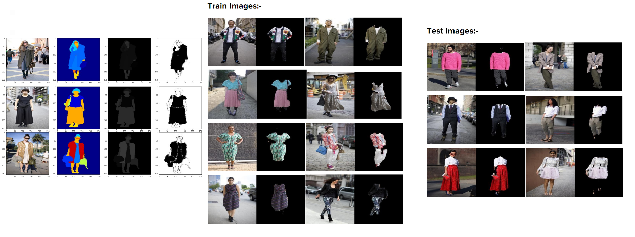
Objective: Apparel segmentation
 Smart mirrors have existing large database containing apparels of various categories like shirts, suits, trousers, sarees, etc. Currently, the apparels are segmented manually from images. This is a time taking procedure, requires man power, and may not be accurate (as exact shapes of the apparel cannot be extracted manually). The objective is to develop methods to extract the apparels from images.
Data – Cloth-co-parsing dataset was used in “Clothing Co-Parsing by Joint Image Segmentation and Labeling (https://arxiv.org/abs/1502.00739)” Wei Yang, Ping Luo, and Liang Lin. The data (Clothing Co-Parsing (CCP) Dataset) were taken from Wei Yang github repository.
The data consists of images along with semantics segmentation output of 59 classes such as ‘null’, ‘accessories’, ‘bag’, ‘belt’, ‘blazer’, ‘blouse’, ‘bodysuit’, ’boots’, ‘bra’, ‘bracelet’, ‘cape’, ‘cardigan’, ‘clogs’, ‘coat’, ‘dress’, ‘earrings’, ’flats’, ‘glasses’, ‘gloves’, ‘hair’, ‘hat’, ‘heels’, ‘hoodie’, ‘intimate’, ‘jacket’, ‘jeans’, ‘jumper’, ‘leggings’, ‘loafers’, ‘necklace’, ‘panties’, ‘pants’, ‘pumps’, ‘purse’, ‘ring’, ‘romper’, ‘sandals’, ‘scarf’, ‘shirt’, ‘shoes’, ‘shorts’, ‘skin’, ‘skirt’, ‘sneakers’, ‘socks’, ‘stockings’, ‘suit’, ‘sunglasses’, ‘sweater’, ‘sweatshirt’, ‘swimwear’, ‘t-shirt’, ‘tie’, ‘tights’, ‘top’, ‘vest’, ‘wallet’, ‘watch’, ‘wedges’, etc.).
Images were converted into grayscale based on class labels of pixels. Labels corresponding to clothes were identified and images were converted in to binary (if pixel is cloth then 1 else 0). These binary images were expected output of the deep learning model. A training accuracy of 0.95 with a loss of 0.12, and test accuracy of 0.94 and loss of 0.16 was achieved.
Mobile App Design & Development for BappCo Cal
(In partnership with Culkey Foundation and Bangalore Press – The Bangalore Printing & Publishing Co. Ltd.)
- Development of coordinate system for digitized world Calendar/ Almanac.
- Setting the data frame to the projection/coordinate system (datum) such as WGS84 using Web Mercator.
- Computation of sunrise and sunset timings for different geographical locations.
- Development of an integrated open source application for Almanac.
- Integration of the following API Repositories such as Sunrise, Sunset, Moonrise, Moonset, Vaara/Thithi, Moon Zodiac (Nakshathra), Rahu/Yama Ganta/Guli Kaala, Abhijit Muhurtham (Good Time in a Day).
The project included (i) development of user journey mind map for crowd source Culture Wiki, (ii) Database development structure for Culture Wiki, (iii) Database architectural design, (iv) Wireframe design for coordinate system, and development of function for latitude and longitude representation, (v) API design, and (vi) API development and UI/UX implementation for Mobile App.