Spatial Computing & Earth Observation: Research Landscape
Milestones & Breakthroughs in Spatial Computing & Earth Observation
A chronological timeline of key satellite missions, open datasets, and algorithmic advancements.
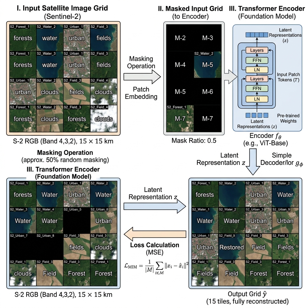
Foundation Models
Remote Sensing Foundation Models
- Establishes a paradigm shift from training task-specific models from scratch to self-supervised representation learning, where massive networks are pre-trained on diverse, unlabeled satellite imagery before being fine-tuned for downstream tasks.
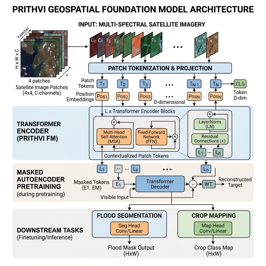
- Leverages NASA and IBM's Prithvi model (Jakubik et al., 2023), which utilizes a Masked Autoencoder (MAE) architecture trained on Harmonized Landsat Sentinel-2 (HLS) data to drastically reduce the labeled training data needed for downstream tasks like flood mapping and crop classification.
- Introduces foundational self-supervised frameworks such as SatMAE (Cong et al., 2022) for multi-spectral time-series and Scale-MAE (Reed et al., 2023) for scale-aware multi-scale geospatial representations.
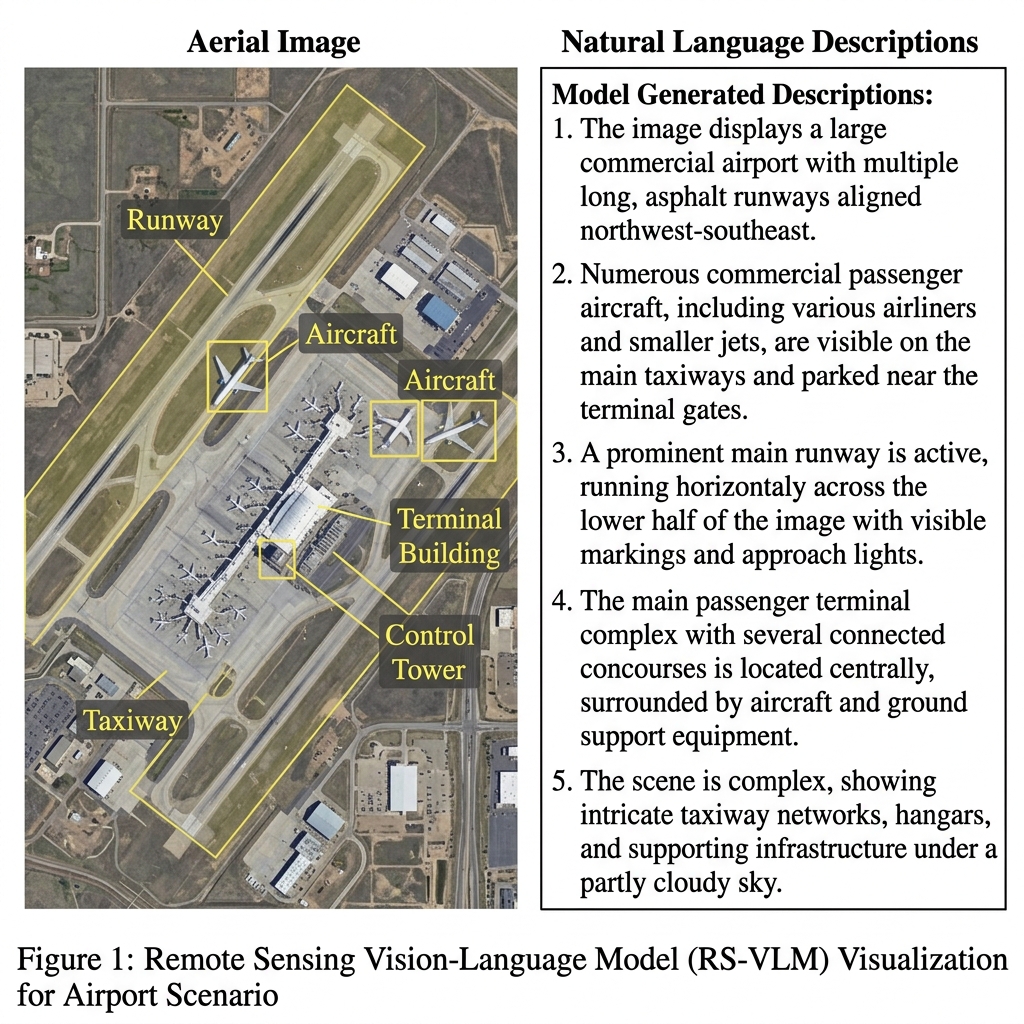
Vision-Language Models
Multimodal RS Foundation Models
- Fuses multi-spectral and high-resolution satellite imagery with rich textual descriptions and structural metadata, enabling vision-language alignment for cross-modal search, natural-language visual question answering, and zero-shot scene classification.
- Features the RemoteCLIP framework (Liu et al., 2024), which adapts contrastive language-image pre-training to Earth observation, accounting for multi-resolution data, varying bands, and complex geographic scales.
- Includes conversational and grounded multi-modal assistants like GeoChat (Tan et al., 2023), capable of localized object referential dialogue and multi-spectral reasoning over satellite scenes.
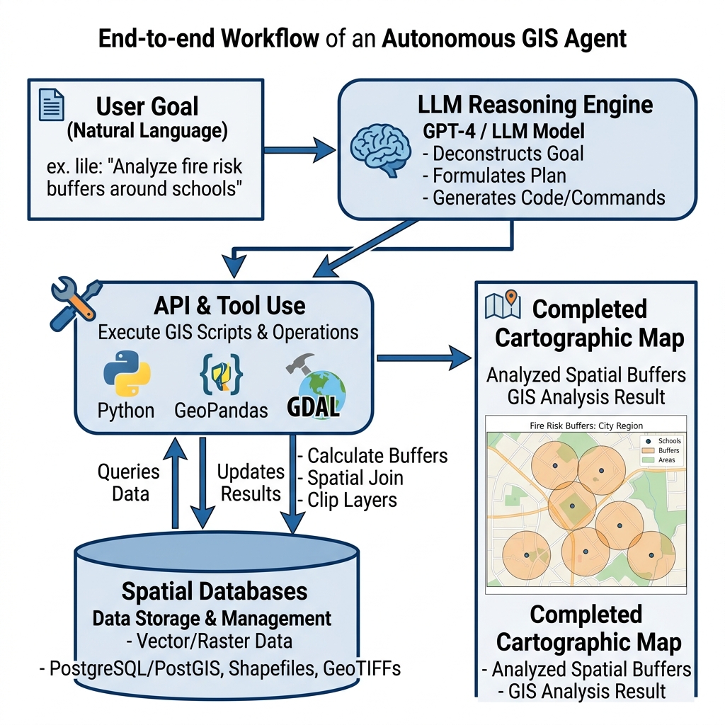
GeoAI / LLMs
Autonomous GIS Agents
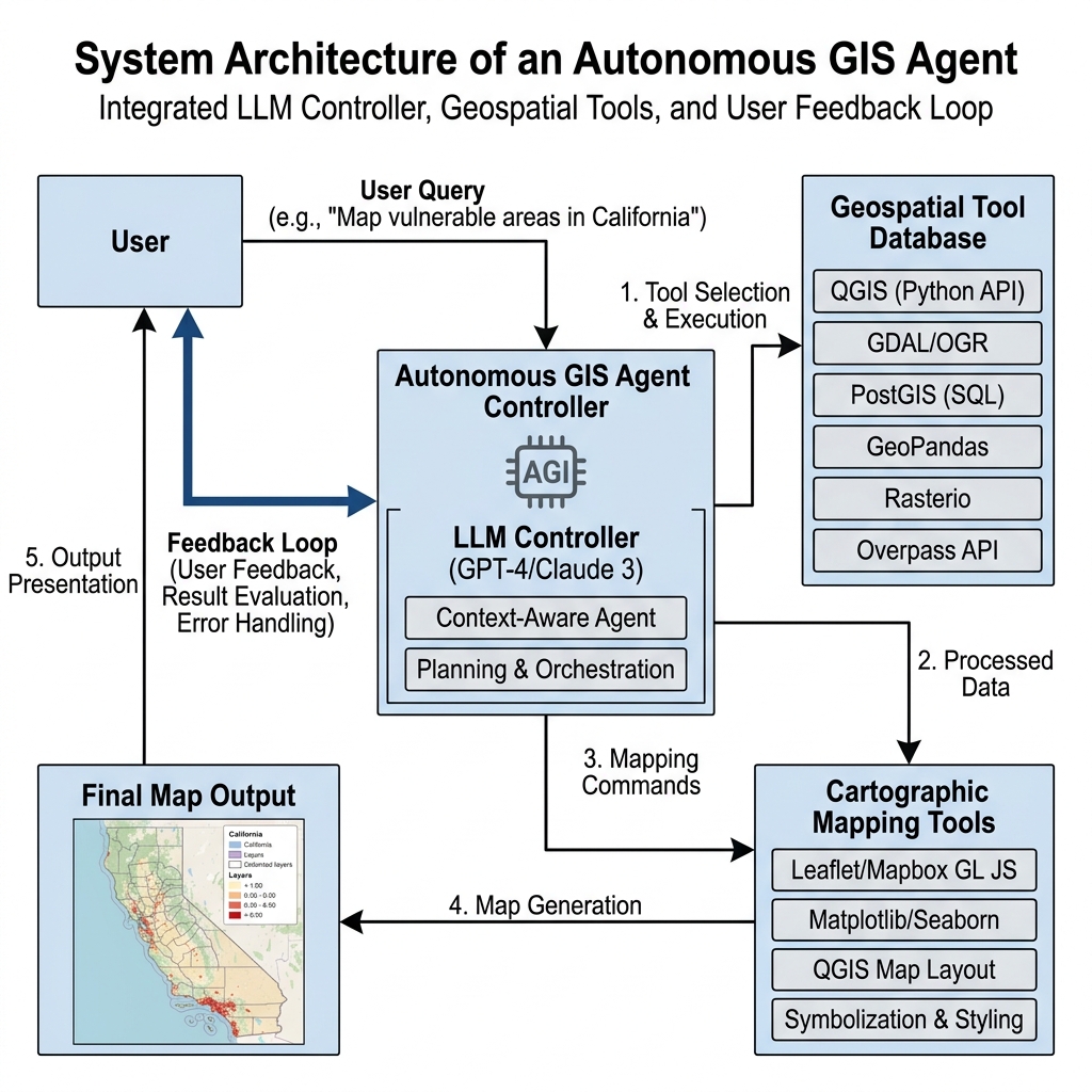
- Represents the transition from static, manually operated desktop mapping software to dynamic, LLM-powered reasoning systems that programmatically write code, call APIs, debug execution blocks, and orchestrate complex geospatial analytical workflows.
- Guided by the Autonomous GIS Research Agenda (Li et al., 2025), which outlines a critical conceptual roadmap for integrating generative AI with traditional spatial information sciences.
- Demonstrated by agentic architectures like GeoGPT (Zhang et al., 2023), which understands user requests in natural language, formulates task execution plans, and retrieves spatial information autonomously.
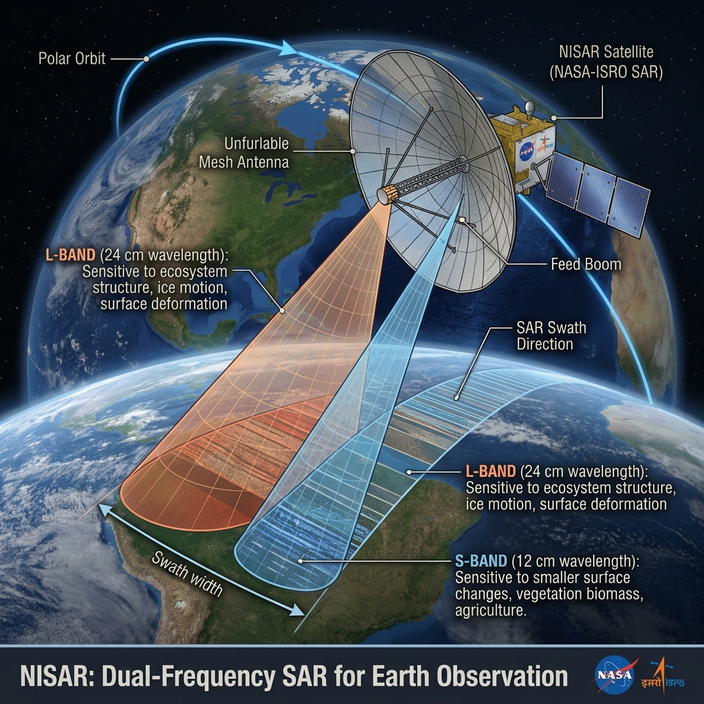
Satellite Mission / SAR
NISAR Mission Launch
- Expands active microwave Earth observation with the launch of the joint NASA-ISRO Synthetic Aperture Radar (NISAR) satellite, operating in both L-band and S-band frequencies to map the globe every 12 days under all-weather, day-night conditions.
- Supported by the NASA-ISRO SAR Mission Portal, which distributes high-resolution polarimetric radar imagery and provides tools for environmental tracking.
- Documented in the NISAR Science Users' Handbook, detailing scientific methodologies for measuring sub-centimeter land deformation, glacier velocities, forest biomass, and agricultural changes.
High-resolution Optical
WorldView Legion Operational
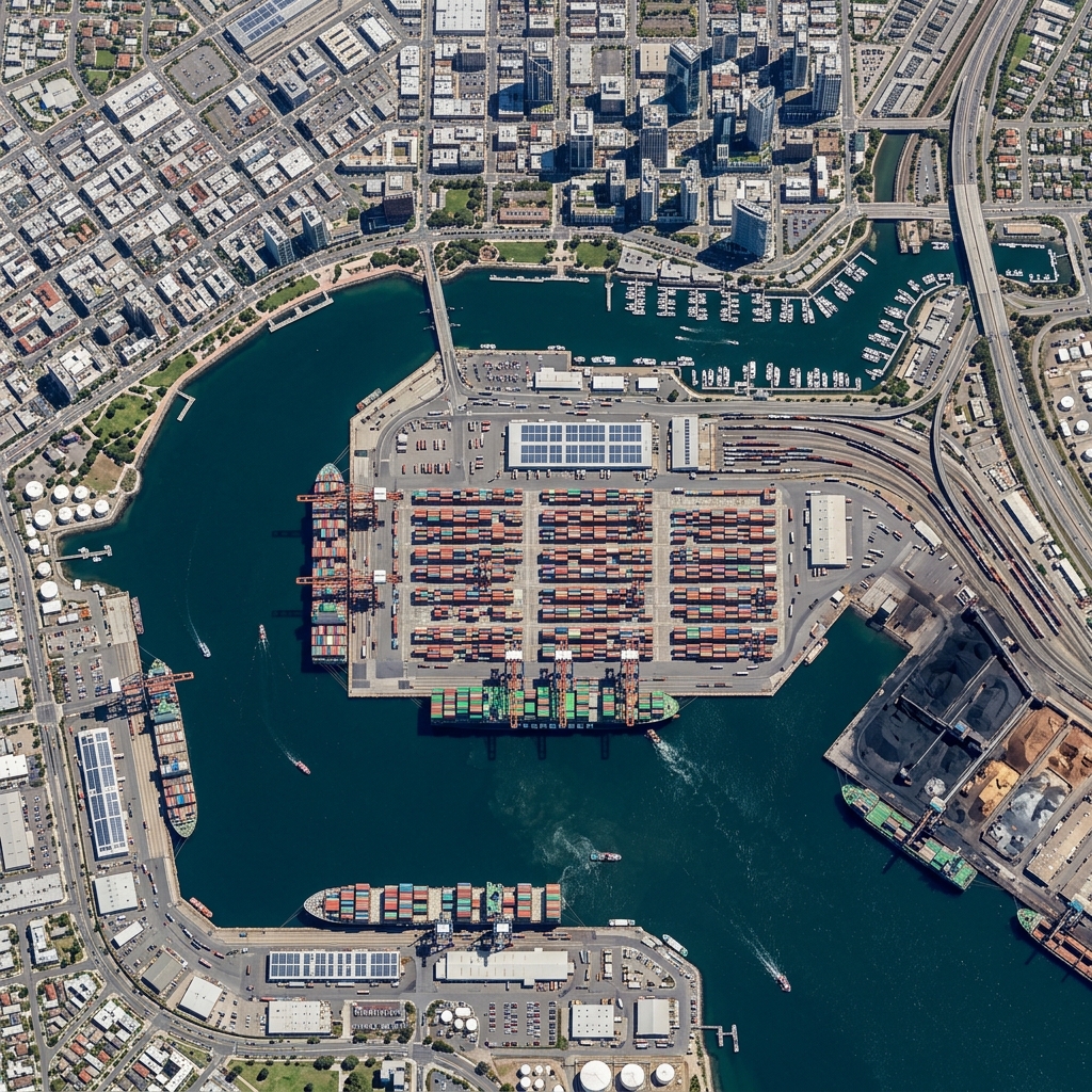
- Revolutionizes high-resolution commercial Earth observation by deploying Maxar's WorldView Legion constellation, delivering sub-meter (30cm) resolution optical imagery with revisit frequencies of up to 15 times daily over critical urban and environmental hotspots.
- Detailed in the Maxar WorldView Legion Specifications, outlining the constellation's configuration, spectral bands, and sub-meter tasking capabilities for emergency response and asset tracking.
Deep Learning
Mamba / State-Space Models in RS
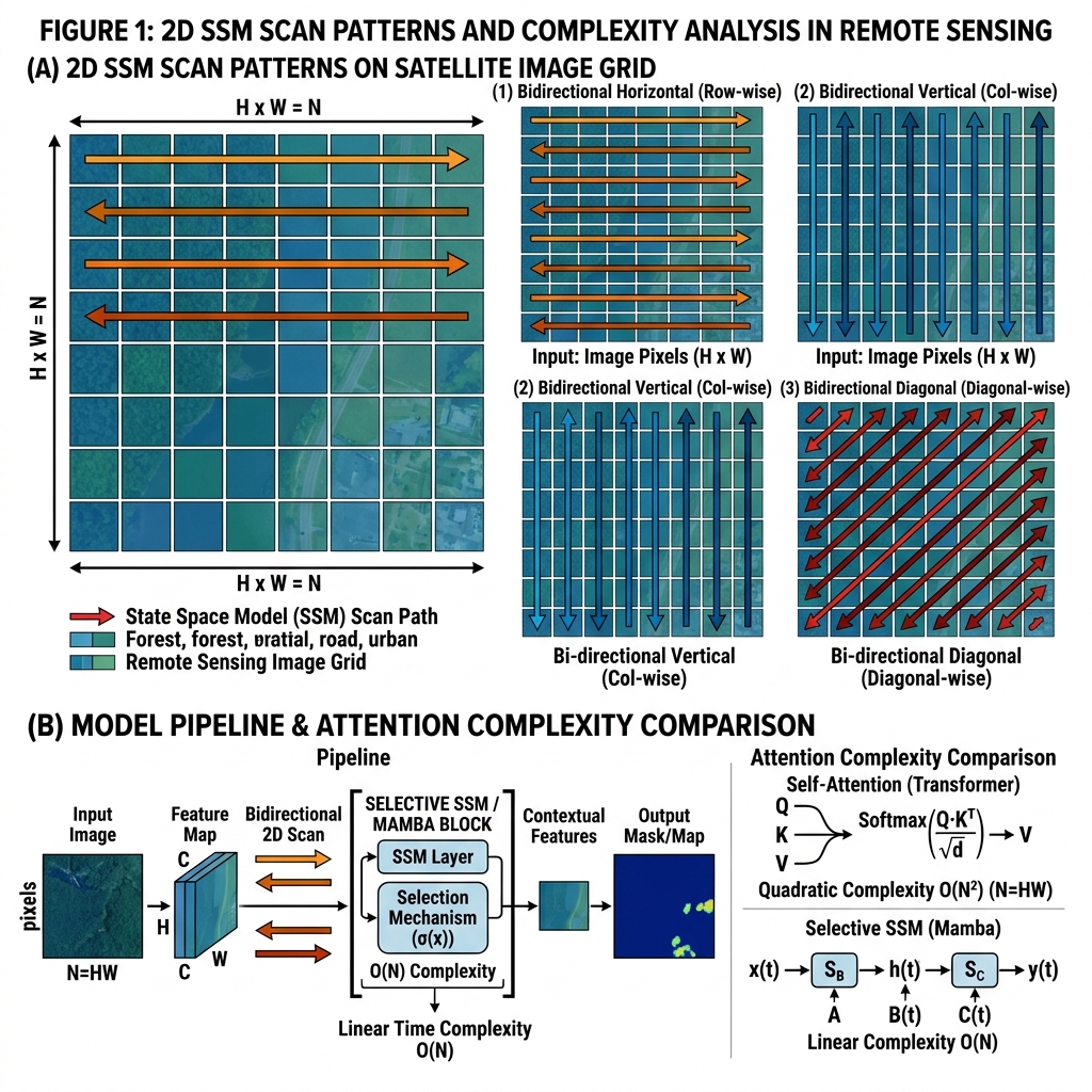
- Introduces Selective State Space Models (Mamba) into remote sensing to overcome the quadratic complexity bottleneck of traditional self-attention Transformers, enabling high-speed sequence modeling on massive satellite image swaths and long temporal series.
- Validated by research such as Rethinking State Space Models for Remote Sensing (Zhao et al., 2024), demonstrating Mamba's linear scaling advantages and high accuracy in land-cover classification and change detection.
- Showcased by frameworks like Pan-Mamba (He et al., 2024), which applies selective state-space modeling to pan-sharpening, achieving state-of-the-art spatial resolution enhancement with low computational overhead.
Desktop GIS Automation
GIS Copilot / QGIS AI Ecosystem
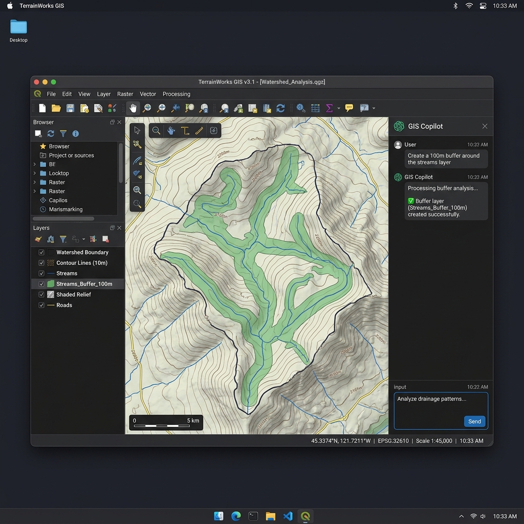
- Brings generative AI assistants directly into the workflow of GIS analysts by embedding natural-language copilot sidebars into popular desktop suites, translating plain-English descriptions into execute-ready python scripts.
- Leverages the LLM-Geo Framework (gladcolor, 2023), which allows users to perform complex spatial processing tasks, automated data retrieval, and chart generation by directing an LLM backend.
- Supported by the QGIS AI Plugin Directory, documenting community plugins that automate buffer creation, coordinate conversions, and shapefile formatting directly within the QGIS workspace.
Foundation Models
EarthPT
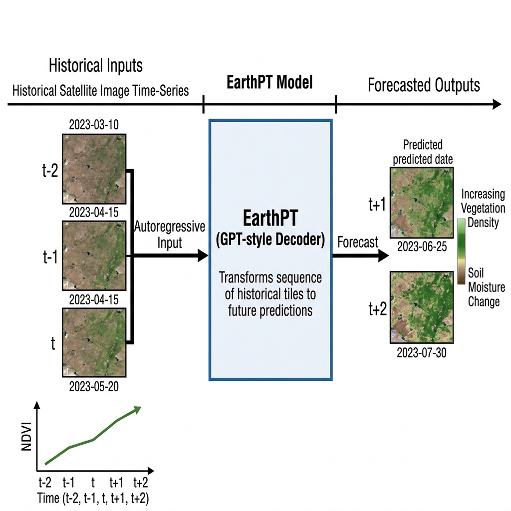
- Establishes a novel autoregressive foundation model design for Earth observation by treating pixel-level, multi-spectral band measurements over time as discrete, sequential tokens, mirroring how language models generate text.
- Detailed in the EarthPT Research Paper (2023), proving that autoregressive pretraining enables highly accurate, long-range forecasting of agricultural vegetation indices, soil moisture levels, and climatic anomalies.
Open Data / GIS
Overture Maps Open Global Dataset
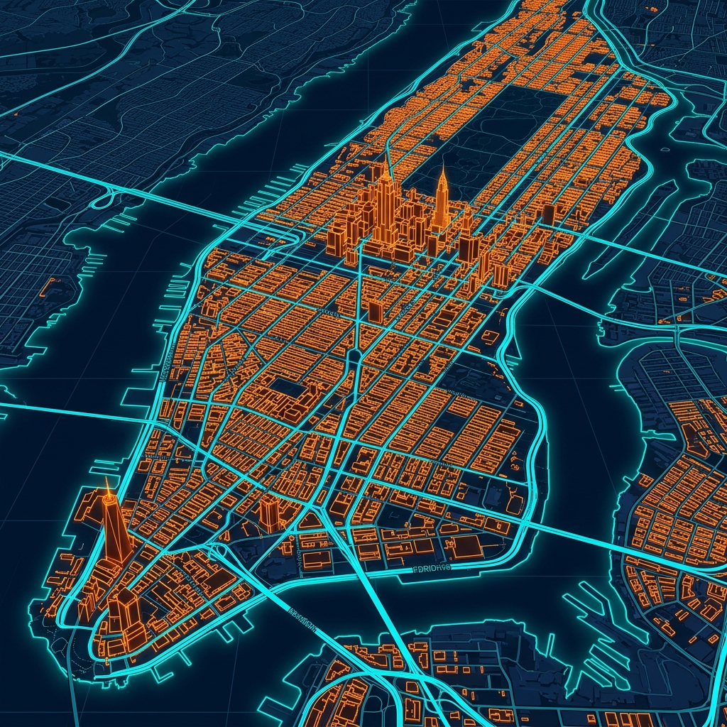
- Standardizes global vector mapping data by releasing unified, validated datasets spanning building footprints, transportation networks, administrative boundaries, and points of interest, developed as a collaborative initiative by major tech corporations.
- Distributed through the Overture Maps Foundation Portal, offering developers a structured, quality-controlled, and open-source spatial database designed to integrate seamlessly into modern mapping applications.
Data Operations
Geospatial Annotation Pipeline
- Overcomes the severe training data bottleneck in remote sensing by developing automated, high-throughput label curation pipelines that fuse advanced machine learning pre-segmentation with rigorous human-in-the-loop validation.
- Operates via platforms like the Scale AI Geospatial Platform, which provides high-fidelity, pixel-level training datasets for segmentation, object detection, and change detection in multi-spectral satellite and aerial imagery.
LiDAR / 3-D RS
GEDI Global Forest Structure Release
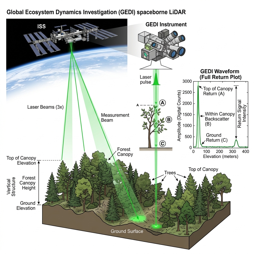
- Provides the first high-resolution, global 3D dataset of forest canopy heights and vertical canopy profiles, captured by NASA's Global Ecosystem Dynamics Investigation (GEDI) spaceborne wave-form LiDAR instrument on the International Space Station.
- Supported by the NASA GEDI Mission Portal, which distributes spatial data tools and mission updates for terrestrial ecosystem monitoring.
- Archived in the GEDI Forest Structure Datasets (Dubayah et al., 2020), which serve as the primary global reference for estimating forest carbon stocks, biomass density, and biodiversity indices.
Data Standards
STAC 1.0 Adoption
- Standardizes spatial catalog metadata through the industry-wide adoption of the SpatioTemporal Asset Catalog (STAC) 1.0 specification, enabling developers to query, discover, and analyze multi-sensor raster archives directly on cloud object storage.
- Hosted on the STAC Specification Portal, providing schemas, APIs, and community tools that allow cloud-native geospatial software to interact with petabyte-scale archives without local downloading.
Cloud Analytics
Google Earth Engine
- Revolutionizes environmental monitoring by providing a multi-petabyte public data archive of satellite imagery coupled with high-performance, parallel-computing servers that execute continent-scale analyses in minutes rather than weeks.
- Described in the seminal paper Google Earth Engine: Planetary-scale geospatial analysis (Gorelick et al., 2017), outlining GEE's architecture, APIs, and its transformative role in climate research, deforestation monitoring, and agricultural science.
Foundational Publications by Research Stream
Pivotal research papers that established key paradigms in Geospatial AI, multimodal data fusion, and digital twins.
Explore key academic publications categorised by primary research stream.
Transformer Architectures
Tseng et al. · 2024 — Lightweight masked transformer for multisensor RS time series.
Vision Transformers
Reed et al. · 2023
Masked Pretraining
Cong et al. · 2022
Geospatial Foundation Models
Jakubik et al. · 2023 — IBM/NASA masked autoencoder built on Harmonized Landsat Sentinel data.
Reasoning Agents
Li et al. · 2025 — Critical research roadmap mapping the transition from assisted GIS to fully autonomous GIS agents.
Multi-Agent Systems
Zhang et al. · 2024
Geospatial LLMs
Zhang et al. · 2023
Vision-Language Models
Radford et al. · 2021
Remote Sensing VLMs
Liu et al. · 2024
SAR-Optical Fusion
Ghamisi et al. · 2019
Digital Twin Theory
Grieves & Vickers · 2017
Urban Digital Twins
Lei et al. · 2023
BIM–GIS Integration
Representative survey · 2020
Analysis Ready Data Cubes
Schramm et al. · 2021
EO Data Catalogs
Montero et al. · 2024
Distributed Analytics
Xu et al. · 2023
Curated by the Spatial Computing Lab, IIIT Bangalore · Data sourced from institutional research reviews.
×